 |
| Nevsehir |
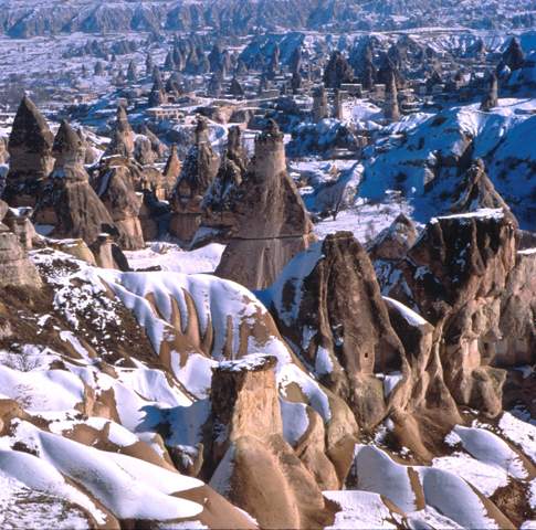
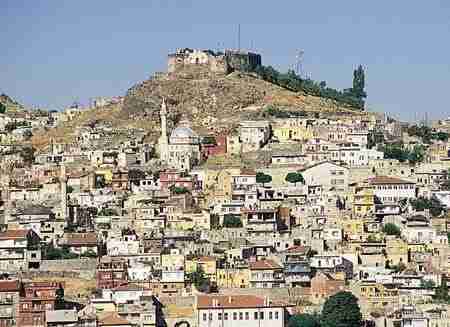
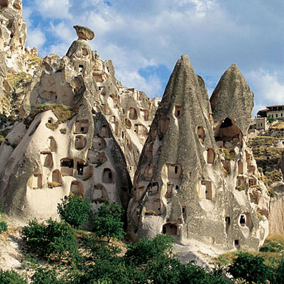
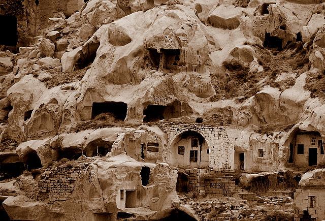
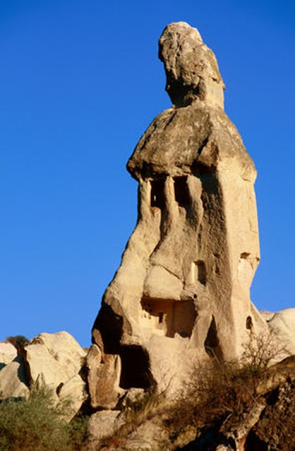
The province of Nevşehir is one of the major cities of Cappadoccia Region and displays a beautiful combination of nature and history. The geographic movements had formed the fairy chimneys and during the historical development process, mankind had settled and inhabited these natural wonders, fairy chimneys and carved houses and churches inside these formations and adorned these settlements with frescos, carrying the traces of the thousands of years of their civilizations
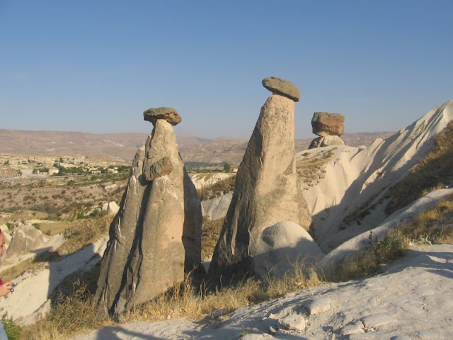
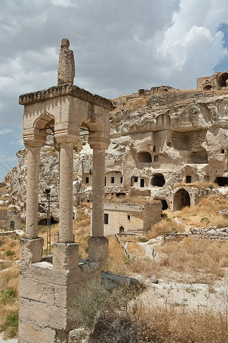
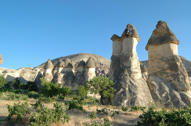
The ancient region of Cappadocia is located in central Anatolia between the cities of Nevsehir, Nigde and Kayseri. Millions of years ago violent eruptions of the volcanoes Mt. Erciyes and Mt. Hasan covered the surrounding plateau with tuff. Wind and weather have eroded the soft volcanic rock into hundreds of strangely shaped pillars, cones and "fairy chimneys", in colors ranging from pink to green and yellow. From the ancient times, men have hallowed out these soft rocks, and they have made countless cave churches, chapels and monastries.
 |
| Nevsehir |
The churches are from the early Christianity. The art style of the churches can be classified into two categories: the 8th and 9th century are the iconoclastic years - the 10th to the 13th centuries whose decorations represent the lives of Christ and various Saints. The architectural plans of the churches are uncomplicated.
Goreme and Urgup are two lively tourist centers. There are cave dwellings, as well as the rock cones in and around these cities. Avanos, on the banks of Kizilirmak river and Ortahisar are less visited towns.
Superb views of the Cappadocia valley can be seen from the castle located in Uchisar.
Goreme Open Air Museum is a complex of churches and chapels, dating back to 10th century. There are great frescoes in many, Yilanli Church, Tokali Church are among the most important.
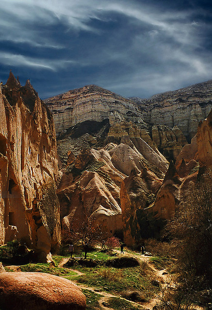
Zelve is one the most impressing valleys in the region offering a more disorganised and rough hike.
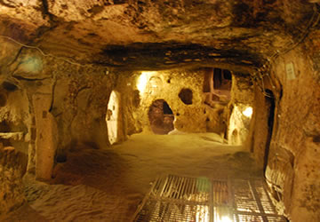
Also there are a number of underground cities used by Christians hiding from enemies. There were rooms for grain storage, sleeping chambers, kitchens and ventilation shafts.
Underground cities of Kaymakli and Derinkuyu are the two most important. There are also two others named Mazi and Ozkaynak.
Cappadocia is an important area for shopping, with wonderful carpets and kilims and very local wines. It is also a great region for trekking and the scenery is wonderful in all seasons for photograph taking.
Source : wikitravel
 |
| Nevsehir |
 |
| Nevsehir |
 |
| Nevsehir |
 |
| Nevsehir |
 |
| Nevsehir |
 |
| Nevsehir |
 |
| Nevsehir |
 |
| Nevsehir |
 |
| Nevsehir |
 |
| Nevsehir |
 |
| Cappadocia |
Cappadocia (Turkish: Kapadokya) is an area in Cappadocia in Turkey best known for its unique moon-like landscape, underground cities, cave churches and houses carved in the rocks.
The Cappadocian Region located in the center of the Anatolian Region of Turkey, with its valley, canyon, hills and unusual rock formation created as a result of the eroding rains and winds of thousands of years of the level, lava-covered plain located between the volcanic mountains Erciyes, Melendiz and Hasan as well as its troglodyte dwellings carved out of the rock and cities dug out into underground, presents an otherworldly appearance. The eruptions of these mountains which were active volcanoes in geological times lasted until 2 million years ago. A soft tuff layer was formed, 150 m in thickness, by the issuing lavas in the valley surrounded by mountains. The rivers, flood water running down the hillsides of valleys and strong winds eroded the geological formations consisting of tuff on the plateau formed with tuff layers, thus creating bizarre shapes called fairy Chimneys.
 |
| Cappadocia |
These take on the names of mushroom shaped, pinnacled, capped and conic shaped formations. The prehistoric settlements of the area are Koskhoyuk (Kosk Mound) in Nigde, Aksaray Asikli Mound, Nevsehir Civelek cave and, in the southeast, Kultepe, Kanis and Alisar in the environs of Kayseri. This area with unusual topographic characteristics was regarded as sacred and called, in the Scythian/Khatti language, as Khepatukha, meaning "the country of the people of the chief god Hepat", although there are more poetic claims on the origin of the region's name, such as the Old Persian Katpatuka, which allegedly means "the land of beautiful horses". The tablets called Cappadocian Tablets and the Hittite works of art in Alisar are of the important remains dating from 2000s B.C. After 1200s B.C., the Tabal principality, of the Khatti Branches of Scythians, became strong and founded the Kingdom of Tabal. Following the Late Hittite and Persian aras, the Cappadocian Kingdom was established in 332 B.C. During the Roman era the area served as a shelter for the early escaping Christians. There are also several underground cities used by early Christians as hideouts in Cappadocia.
source: wikitravel
 |
| Cappadocia |
 |
| Cappadocia |
 |
| Cappadocia |
 |
| Cappadocia |
 |
| Cappadocia |
 |
| Cappadocia |
 |
| Cappadocia |
 |
| Cappadocia |
 |
| Cappadocia |
.jpg) |
| Cappadocia |
.jpg) |
| Cappadocia |
 |
| Cappadocia |
 |
| Cappadocia |
 |
| Cappadocia |
 |
| Cappadocia |
 |
| Cappadocia |
 |
| Cappadocia |
 |
| Cappadocia |
 |
| Cappadocia |
 |
| Cappadocia |
 |
| Cappadocia |
 |
| Cappadocia |


.jpg)






.jpg)
.jpg)


